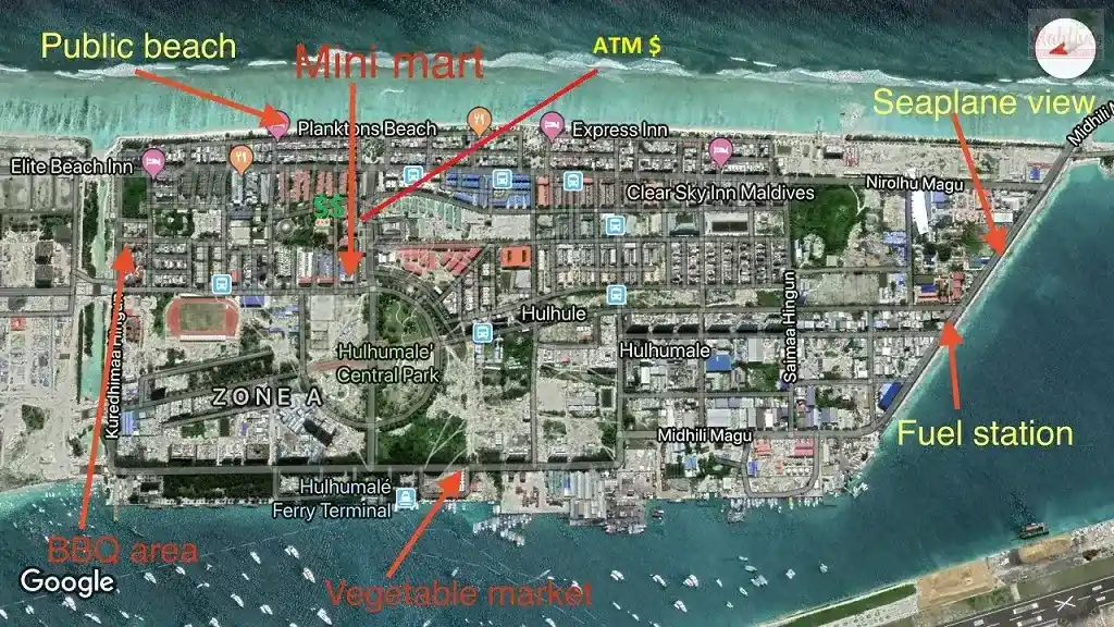
Hulhumalé map is a reclaimed island located in the south of North Male Atoll, Maldives. The artificial island was reclaimed to establish a new land mass required to meet the existing and future housing, industrial and commercial development demands of the Malé region. The official settlement was inaugurated by President Maumoon Abdul Gayoom on May 12, 2004. Untill now, the Male city is considered as one of the most desnsly polpulated place in the world. Hulhumale is also one of the fastest growing tourism destinations in the Maldives. Situated next to the airport not only reduce the transportation fees, but also allows you to take s taxi direct from the airport to your hotel in hulhumale. Male city and hulhumale are the only two islands which are connected to the airport, rest of all islands requires either a speed boat or domestic flight transfer.

Hulhumale is next to Male Airport and only takes 15 minutes by Taxi from Airport.